Purpose
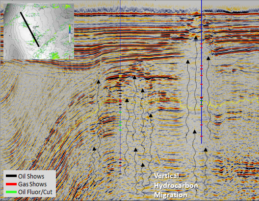
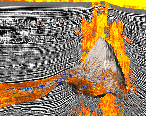
Most hydrocarbon producing basins are dominated by vertical hydrocarbon migration. This vertical hydrocarbon migration is often directly detected in the seismic record as zones of vertically chaotic, low energy data, or "gas chimneys". Chimneys have often been observed near producing oil and gas fields and dry holes, however their presence has never been systematically documented.
The purpose of the Chimney Atlas is to improve risk assessment for vertical charge and seal by providing analogs for exploration prospect evaluations. Major exploration companies have recognized that seal or charge is a major cause for exploration failure, and it is essential to address these risks. The morphology of chimneys immediately below the reservoir provides us with information about the vertical hydrocarbon charge into the reservoir. The morphology of the chimneys immediately above the reservoir provide information about the top seal.
The Chimney Atlas is a collection of published papers, books, posters, video’s and annotated PowerPoint presentations concerning seismic chimney processing and interpretation. Where possible the material is geographically referenced and accessible from a map.
The Atlas is open to all peer-reviewed material. Please contact
The Atlas contains references to sites where publications can be bought and references to copies of
published materials. If anyone objects to the latter form of sharing information because of permission
rights, please contact
Atlas setup
The Chimney Atlas gives an overview of published material concerning processing and interpretation of Chimney Cubes. The material (papers, presentations, video’s etc.) is grouped in four categories:
- Methodology
- Basins/areas
- Fields/prospects
- PowerPoints/videos/books/posters.
PowerPoints are annotated presentations of gas chimney studies over known oil and gas producing reservoirs and examples of studies over dry structures. The latter are examples that were drilled in valid structural traps, containing effective reservoirs, which failed for a lack of charge or seal. The PowerPoints in this Atlas focus on a specific reservoir/trap and serve as analogs to improve the risk assessment for vertical charge and seal for exploration & development prospect evaluations.
History
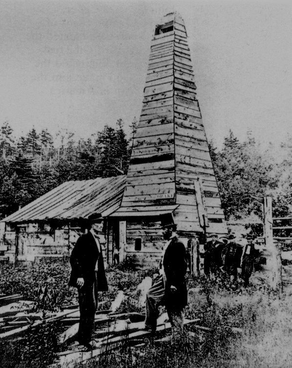
In 1998 dGB and Statoil developed a technique to visualize seismic chimneys. The neural network-based pattern recognition technique delivered a new seismic volume called the "Chimney Cube". The technology was originally intended to facilitate geo-hazard interpretations. Amplitude anomalies linked to chimneys were likely to be gas-filled and had to be avoided in drilling. It was soon realized, that the Chimney Cube also had potential for deep hydrocarbon exploration. Chimneys in a Chimney Cube proved to be traceable from deep down in the basin to the shallow subsurface. In other words they could be used to map fluid migration paths from hydrocarbon source-rock levels to reservoir levels and beyond.
In the years that followed, hundreds of Chimney Cubes were processed to study petroleum systems in many basins around the world. It soon became clear that most hydrocarbon systems are associated with chimneys. This led to a workflow for de-risking prospects for charge and seal. In the workflow chimneys are classified according to their morphology (gas clouds, blowout pipes, along faults) and according to the spatial connection to the trap (charge from below, leakage above, charge/leakage from the side).